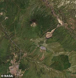
A 200-acre-wide, nearly 300-foot-deep pit in Siberia’s Yana Mountains known as the “Battagayka Crater” is expanding faster than expected due to climate change.
Sometimes called the “Gateway to Hell,” Batagayka Crater first formed when melting of the “permafrost” soil in the Siberian tundra began releasing tons of previously frozen methane, a powerful greenhouse gas, into Earth’s atmosphere.
Now new research has found that the rate of methane and other carbon gases released as the crater deepens has reached between 4,000 and 5,000 tons per year.
The findings, according to the study’s lead author, “demonstrate how rapidly permafrost degradation is occurring.”
He warns that the crater will soon leak all the remaining greenhouse gas it has left.
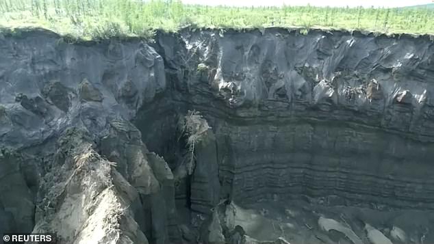
A 200-acre-wide, nearly 300-foot-deep pit in Siberia’s Yana Mountains known as the “Battagayka Crater” (above) is expanding faster than expected due to climate change
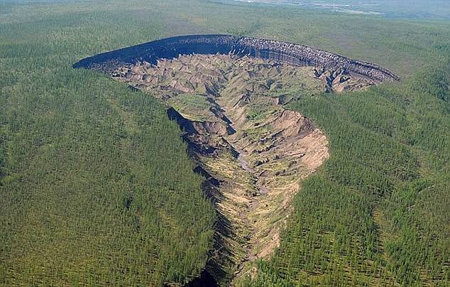
New research has found that the rate of methane and other carbon gases released as the crater deepened (above) reached an estimated 4,000 to 5,000 tons per year
Glaciologist Alexander Kizyakov, the study’s lead author, worked with a dozen other researchers on the new study, published this month in the journal Geomorphology.
Kizyakov and his colleagues found that the crater has almost reached the bedrock, meaning that the melting permafrost that remains to melt and thus generate further collapse has almost entirely melted.
But Kizyakov, who teaches at Lomonosov Moscow State University in Russia, noted that there is still room for the melt to continue sideways.
“Peripheral and upward expansion is expected,” Kizyakov told Atlas Obscura.
“This lateral extension is also limited by the proximity of the bedrock, the summit of which apparently rises to the saddle between the nearest mountains about 550 meters [1805 feet] up,” he explained.
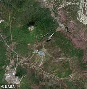
Above, 1999 (left) and 2016 (right) NASA satellite images of the Batagayka Crater expansion
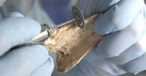
The team was able to develop a 3D model of how the ice permafrost retreated during its decades-long collapse using extensive data from a variety of independent sources.
High-resolution remote sensing—gathered from both satellite data and drone flights over Batagaika—was combined with permafrost and other soil samples in field expeditions in 2019 and 2023.
All this data was fed into their computer models.
This model helped them map and predict the melting of the permafrost’s underlying geologic structure to understand how much and what materials thaw inside it and then what is released, whether into groundwater or into the atmosphere.
The results revealed as Kizyakov said Popular science, “how dynamically landforms change in permafrost regions.”
Nikita Tananaev, a researcher at the Melnikov Permafrost Institute in Yakutsk who was not involved in the new study, noted that this outflow from the crater alone is permanently altering nearby ecosystems.
“This will lead to significant changes in the river habitat and the effect of sediment escaping from the slump [the Batagaika crater] it can even be seen in the Yana River, the big river in the vicinity,” said Tananaev.